Explore Wild New York
 

Vandermark Creek

Vandermark Creek is a small tributary of the upper Genesee River, which it joins near Route 19 in Scio. The stream averages about 15 feet in width and has a gravel and cobble bottom and good water quality. The stream flows primarily through woodland and has generally good bank cover, at least in the stocked section. This stream does not appear to have any fishable tributaries.

In the spring, this stream is stocked with brown trout. The stocked section extends from the most downstream County Road 10 crossing, near the entrance to the Scio Rod & Gun Club, upstream to the Vandermark Road (County Road 10) crossing immediately south of Duke Road, a distance of about 5 miles (the map pin is located in this section near the informal parking area just south of Duke Road). In addition, a small number of wild brook trout are present in Vandermark Creek in the roughly 3-mile-long section below the most upstream crossing of Vandermark Road. However, their numbers have declined in recent years due to the presence of beaver ponds in Vandermark State Forest, which warm and silt the stream (see photos). For an interesting article on brook trout and beavers in Vandermark Creek, see "Brook Trout and Beaver Dams" under Links. The article was written by Walt Franklin, a naturalist, educator, and gifted nature writer from Rexville, New York.

__________________֍__________________

Links to associated resources (Genesee River - State Line to Belmont Dam, and Vandermark State Forest) will be added soon.

Location Map

Photographs

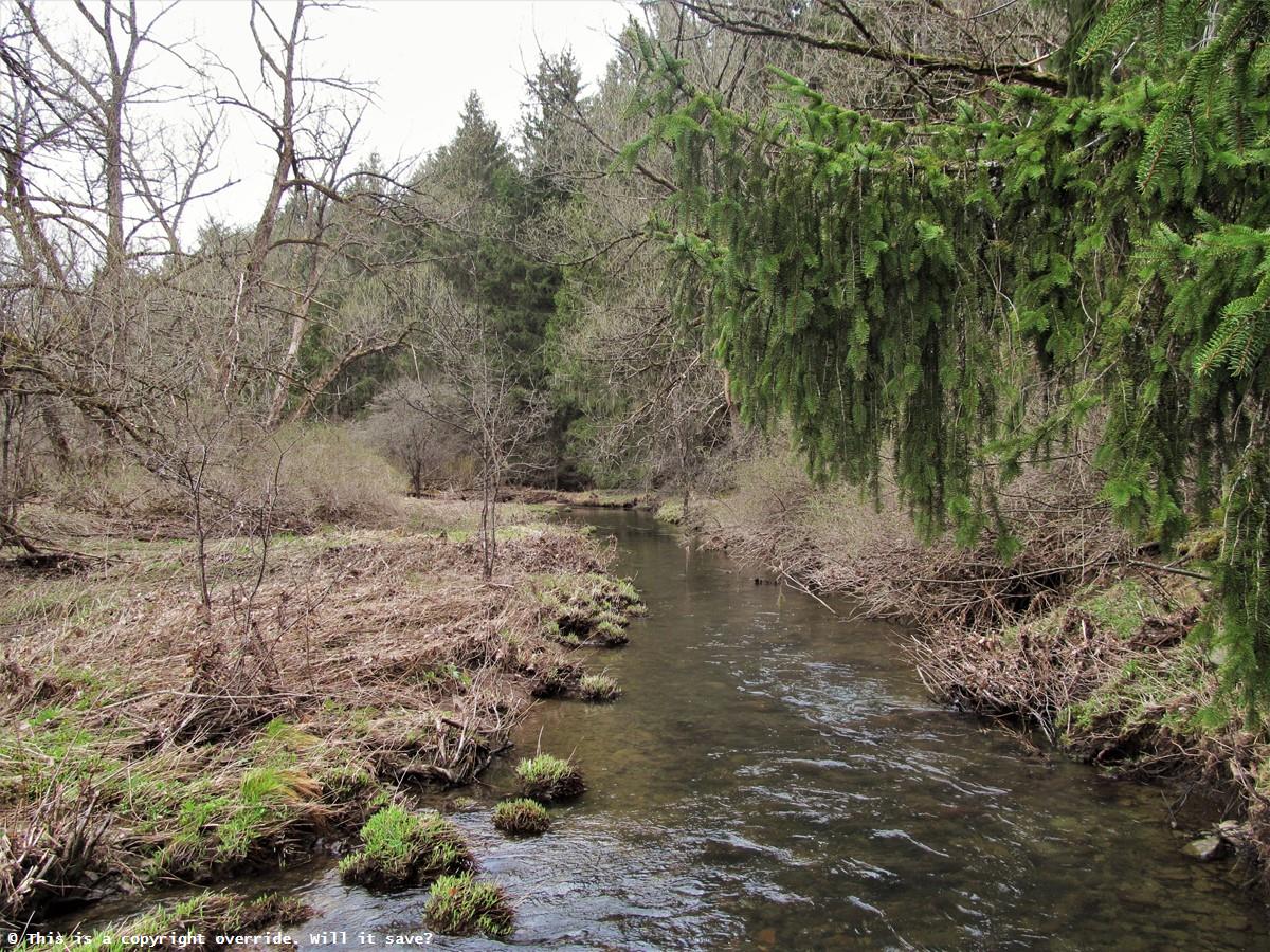
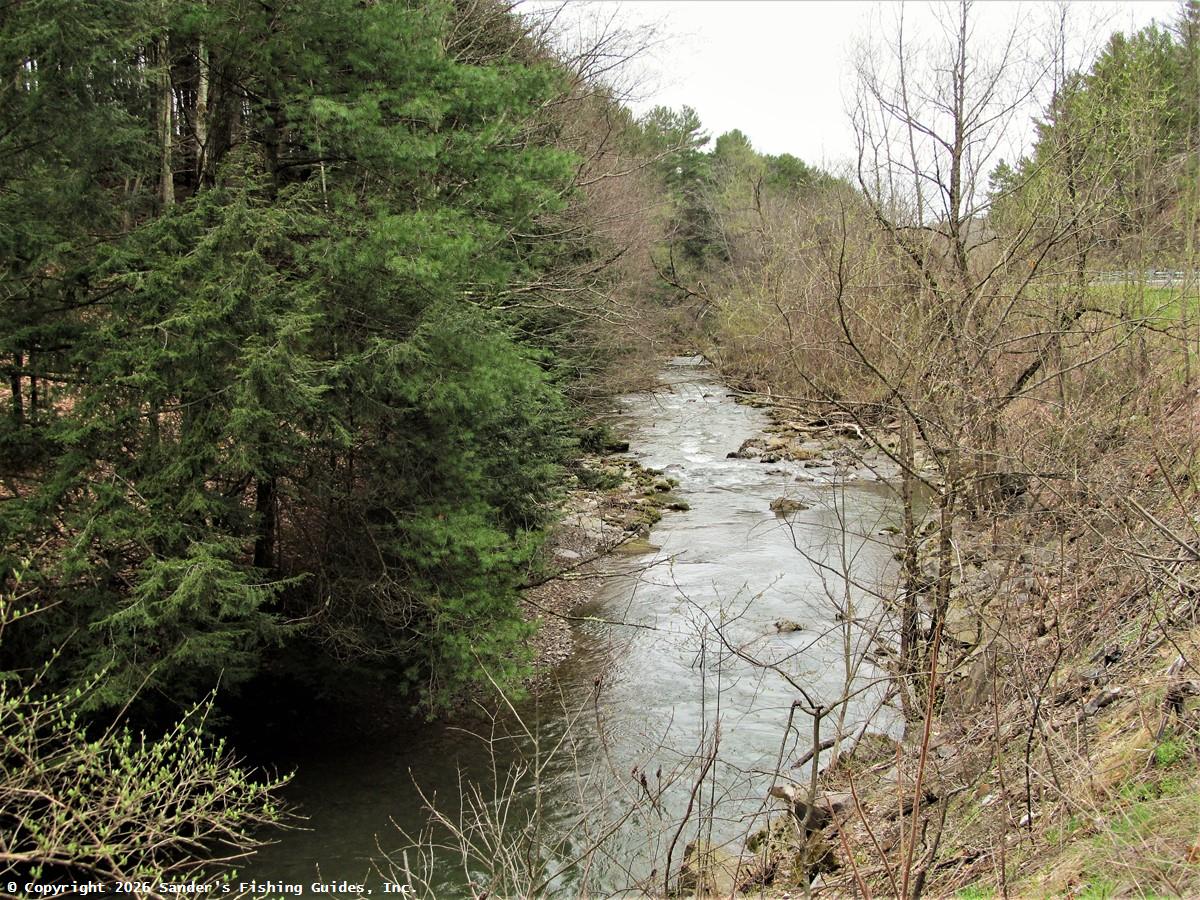
Vandermark Creek, seen looking downstream from Vandermark Road immediately south of Duke Road in April 2019. This is the beginning of the stocked section of the stream, and because this stretch is upstream of most of the beaver ponds, it likely also holds wild brook trout.
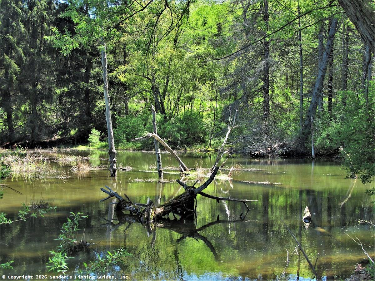
Some sections of Vandermark Creek in Vandermark State Forest have been impacted by beaver activity. Their dams impound the water, causing it to become too warm and silty for brook trout survival. This is just one of several areas within the state forest to be so affected.
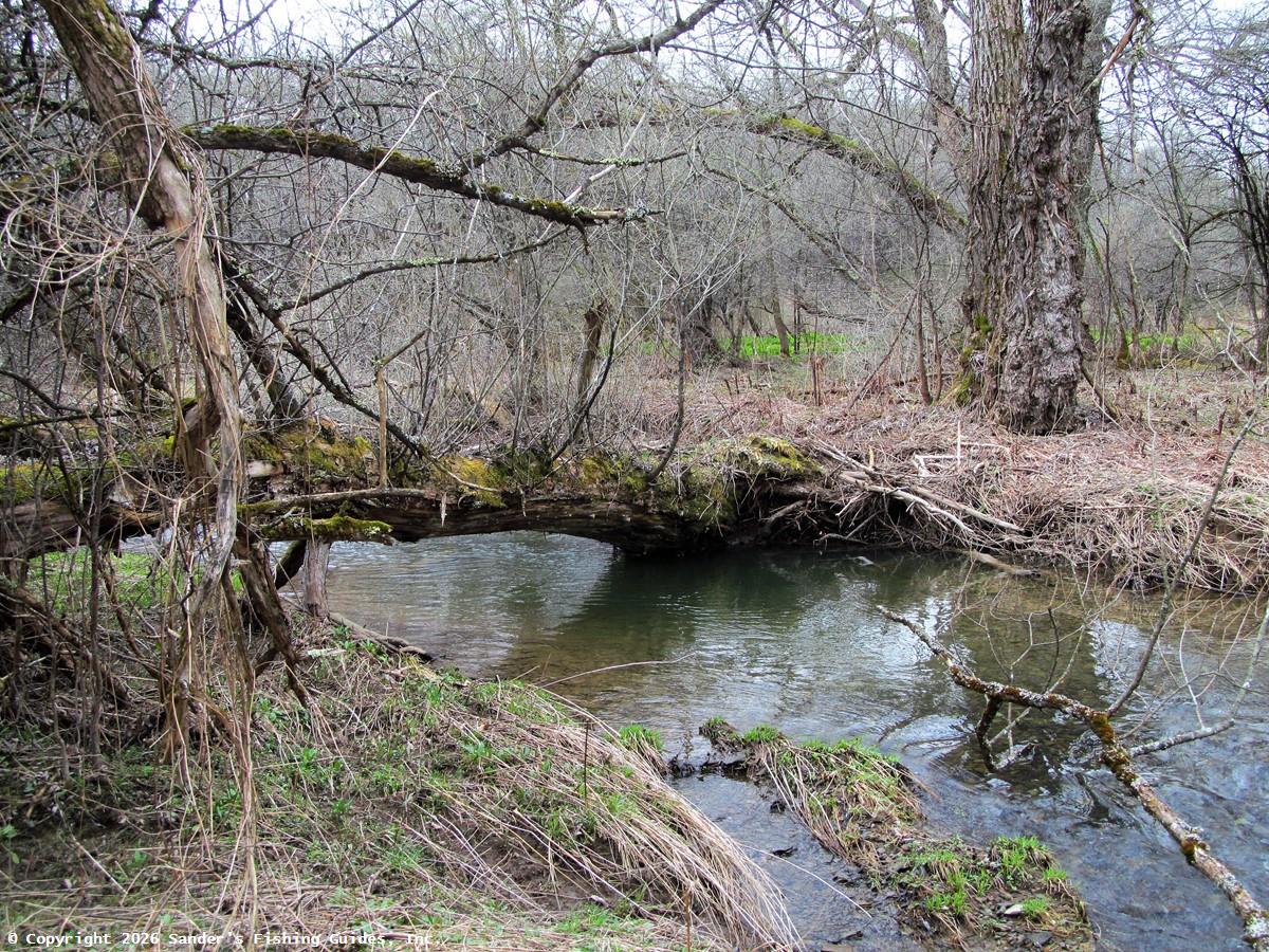
In Vandermark State Forest, some portions of this stream are studded with large downed trees, and if these trees are large enough, they can straddle the stream for years. Some of these trees create logjams, which can alter the course of the stream and create large, deep pools. These pools provide critical habitat for trout and other aquatic species during periods of low water.
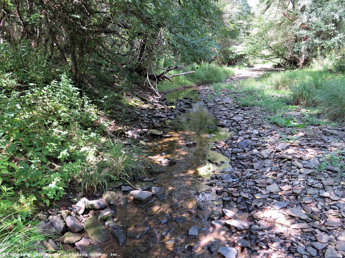
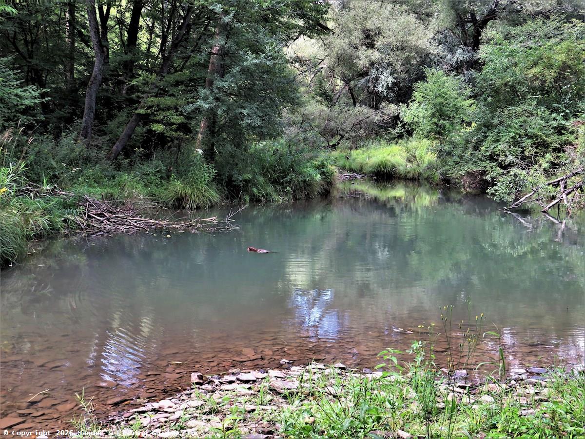
During the hot, dry summer of 2022, much of Vandermark Creek was reduced to a trickle, but there were a surprising number of pools along the stream, some of which were quite large and not the result of beaver activity.
This is the largest pool I encountered while hiking along the stream within the state forest in August of 2022. Although a beaver and its rather ramshackle lodge can be seen in the photo, the pool is not the result of beaver activity; the beaver is just taking advantage of a naturally occurring situation. Such pools may provide refuge for trout during otherwise inhospitable summer conditions.
After leaving Vandermark State Forest, this stream is paralleled and crossed by Vandermark Road (CR 10), providing easy access. Although I didn't see much posting along most of Vandermark Creek, you should obtain permission to fish the portions of the stream not on state property.
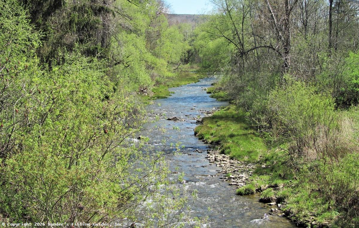
Shown here is the lowermost stocked section of Vandermark Creek. The stocked section extends down to the crossing of CR 10 near the Scio Rod & Gun Club.

Resource Map

See Location Map.

Directions to map pin location


Access

Road Access:

Paralleled and crossed by Vandermark Road (County Road 10). Public access is available along much of this stream where it flows through Vandermark State Forest. The remainder of the stocked section of this stream does not have public fishing right easements but is generally open to fishing by landowners. As some sections within the stocked section are posted, landowner permission should be obtained before fishing this stream except where it flows through public lands.

Note that the parking area near Duke Road identified below is informal. It looks to be the result of an old road realignment project. Also, if you park anywhere along Vandermark Road within the state forest, accessing the stream requires about 200 to 400 feet of bushwhacking.

Boat Launch Site(s):

None.

Fishery Management

Management Category: Stocked: From the most downstream County Route 10 crossing upstream to the County Route 10 crossing immediately south of Duke Road, a distance of about 5 miles. The remainder of the stream is wild/uncategorized.

Fish Species:

  • Brown Trout (stocked)
  • Brook Trout (wild)

Stocking Information: Vandermark Creek is stocked in the spring with brown trout.

Special Fishing Regulations: None. Statewide fishing regulations apply.


Explore Wild New York

Copyright © 2026 Sander's Fishing Guides, Inc.

; ;